

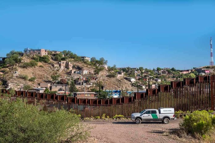
Emergency injunctions are hard to win, and in border-wall fights on tribal lands that difficulty exposes the core legal terrain: unless a tribe can show the federal project exceeds a specific statutory or property boundary, courts will default to federal authority at the preliminary stage while the sovereignty arguments wait for full adjudication.
At a Glance
- A federal judge declined to preliminarily block construction of 62 miles of border wall along the Tohono O’odham Nation’s southern boundary, finding the tribe had not shown likely success on claims that the project would alter reservation boundaries without Congress or constitute trespass.
- The government’s immediate legal footing rests on the Roosevelt Reservation—a 60‑foot federal strip along the international line—and sovereign immunity defenses against trespass claims.
- The Nation’s lawsuit squarely argues ultra vires action under 25 U.S.C. § 398d (which bars changes to reservation boundaries absent Congress) and pleads trespass, preserving those issues for merits review rather than emergency relief.
- This clash fits a recurring pattern: tribes frame wall construction as a sovereignty, cultural‑resource, and environmental incursion; the government frames it as border security within federal land and statutory powers—contests that often turn on site‑specific surveys and historic proclamations.
What the court decided—and what it did not
In denying a preliminary injunction, U.S. District Judge Richard Leon concluded the Tohono O’odham Nation had not, at this early stage, demonstrated that new wall segments would change reservation boundaries without congressional authorization and rejected the tribe’s trespass theory for immediate relief. Preliminary injunctions are an extraordinary remedy; judges look for likely success on the merits, irreparable harm, equitable balance, and public interest. Here, the court’s reasoning hinged on two points: first, that building adjacent to the reservation on federal land does not, by itself, diminish tribal boundaries; second, that the Roosevelt Reservation—President Theodore Roosevelt’s 1907 proclamation reserving a 60‑foot strip of public land along much of the southern border—provides a ready locus for federal construction. The ruling is not a final merits judgment; it clears the way for construction to proceed while litigation continues.
That procedural posture matters. An injunction denial does not settle whether the agency ultimately acted within statutory limits or respected the precise map of federal versus tribal land. It signals that, given the record presented, the government’s jurisdictional theory was sufficiently plausible to avoid an emergency halt, and that the tribe’s boundary and trespass showings were not yet strong enough to overcome the high bar for preliminary relief. The underlying legal questions remain live for fuller briefing and evidence.
The legal architecture: boundaries, proclamations, and ultra vires claims
The Nation’s complaint focuses the merits on two legal fulcrums. First, it invokes the constitutional rule and 25 U.S.C. § 398d’s command that only Congress can alter reservation boundaries; executive agencies cannot, by construction decree, shrink or re‑draw sovereign tribal lines. Second, it pleads trespass, asserting federal actors or contractors would occupy or cross tribal land without consent to execute the plan. Those are classic, cognizable claims in Indian law litigations over land status and federal encroachment; they put the case on a track where surveys, plats, right‑of‑way instruments, and historic conveyances become decisive evidence.
The government’s counter rests on a different set of instruments. The Roosevelt Reservation has long functioned as a narrow federal buffer contiguous to the international line, intended to curb smuggling and provide operational space for federal enforcement—authority subsequent administrations have read as permitting infrastructure within that strip. In the injunction ruling, the court accepted that construction along the existing border, on federal holdings, does not by itself “diminish” a reservation, and—critically—that the record did not show the project would cross into tribal title such that Congress’s boundary power would be implicated at this preliminary stage. Whether specific segments lie atop public land covered by the proclamation or would in fact intrude on tribal parcels is the kind of granular, map‑driven factual issue likely to shape any merits decision.
Why preliminary injunctions so often fail in these cases
When tribes seek to stop construction before it starts, courts demand more than principled sovereignty arguments; they expect precise, site‑by‑site showings that the government will imminently act outside its jurisdiction or in violation of a clear statutory command. Absent that, judges tend to credit federal assertions of authority over border‑security projects and the sovereign immunity backdrop that can complicate tort‑style claims such as trespass. That is the pattern here: the court found no present showing that the agency planned to alter reservation boundaries without Congress, and it declined to treat the project as a trespass entitling the Nation to emergency relief. The practical result: construction can advance while the parties litigate the lines on the map and the scope of the proclamation.
For readers attuned to federal Indian law, this is familiar terrain. Sovereignty is robust in principle but highly dependent on the precise status of the land in question; boundary diminishment is a question for Congress; and agency actions adjacent to reservations are often litigated under parallel statutes—cultural resource laws, environmental review mandates, and rights‑of‑way regimes—alongside property and constitutional theories. The court’s framing does not reject tribal sovereignty; it postpones its vindication, if any, to a fuller record.
How this dispute fits the longer border-wall history
The Tohono O’odham Nation’s case sits squarely within a decade‑plus arc of border‑infrastructure litigation in which tribes argue that walls, patrol roads, and surveillance towers fracture community life across an international line that bisects homelands, disturb sacred and burial sites, and disrupt fragile desert hydrology and species corridors. Federal agencies, by contrast, stress statutory mandates and land authorities that, in their view, permit construction within federal strips adjacent to the line; the conflict thus collapses into whether “adjacent” still means outside tribal title and whether the practical effects of a barrier amount to an invasion of sovereign control. Courts tend to treat those as merits questions and resist emergency intervention unless the record crisply shows an overreach beyond federal land or a clear statutory violation—precisely the posture of the current ruling.
There is also institutional memory at work. Earlier fights along other tribal or culturally sensitive stretches—sometimes resolved via route adjustments, sometimes by litigation over cultural resource statutes—have taught agencies to anchor projects in established federal holdings where possible. The Roosevelt Reservation’s 60‑foot strip is the most legally resilient of those anchors; when disputed segments stray beyond it, tribes have had stronger leverage. That is why, for the Nation’s case, the survey record and historical land status along the 62‑mile span are not arcana; they are the case.
Competing narratives and the narrow role of public rhetoric
Public statements have run along predictable lines. DHS has emphasized ongoing coordination with tribal nations and respect for sovereignty, signaling a preference for consultation while asserting the prerogatives of border security. Those assurances do little legal work at the injunction stage but set the tone for intergovernmental relations as construction logistics unfold. Tribal leaders and allied officials counter that a steel barrier is a blunt instrument—ineffective relative to investments in ports of entry and personnel—and out of step with on‑the‑ground cooperation that already exists between the Nation and Border Patrol. Again, those policy arguments shape public debate and potential settlement dynamics, but in federal court the decisive question remains: where, exactly, does the wall go, and on what legal authority?
The immediate ruling also reflects judicial caution about conflating proximity with boundary change. The court’s line—construction contiguous to a reservation is not ipso facto diminishment—tracks longstanding doctrine that only Congress can shrink a reservation; executive agencies must stay within their lanes. If the Nation can later show, parcel by parcel, that the plan requires entry onto tribal land without a right‑of‑way or congressional action, the legal calculus could shift. Until then, federal land status and the proclamation’s footprint give the government the upper hand in keeping work moving.
What to watch as the case moves forward
Three developments will tell you where this goes. First, the survey record: expect dueling maps tying proposed segments to the Roosevelt Reservation versus tribal parcels, with right‑of‑way documentation (or its absence) under a microscope. Second, statutory overlays: beyond the boundary and trespass theories, claims under cultural and environmental laws—where tribes have prevailed in related contexts—could narrow alignments, reroute segments, or force mitigation if the project touches protected resources. Third, remedies posture: even without a global injunction, targeted relief against discrete intrusions on tribal land remains possible if and when the factual predicate sharpens.
Sources:
washingtontimes.com, azcentral.com, abcnews.com, tonation-nsn.gov, kjzz.org